Ala Wai Watershed Master Mapping Project
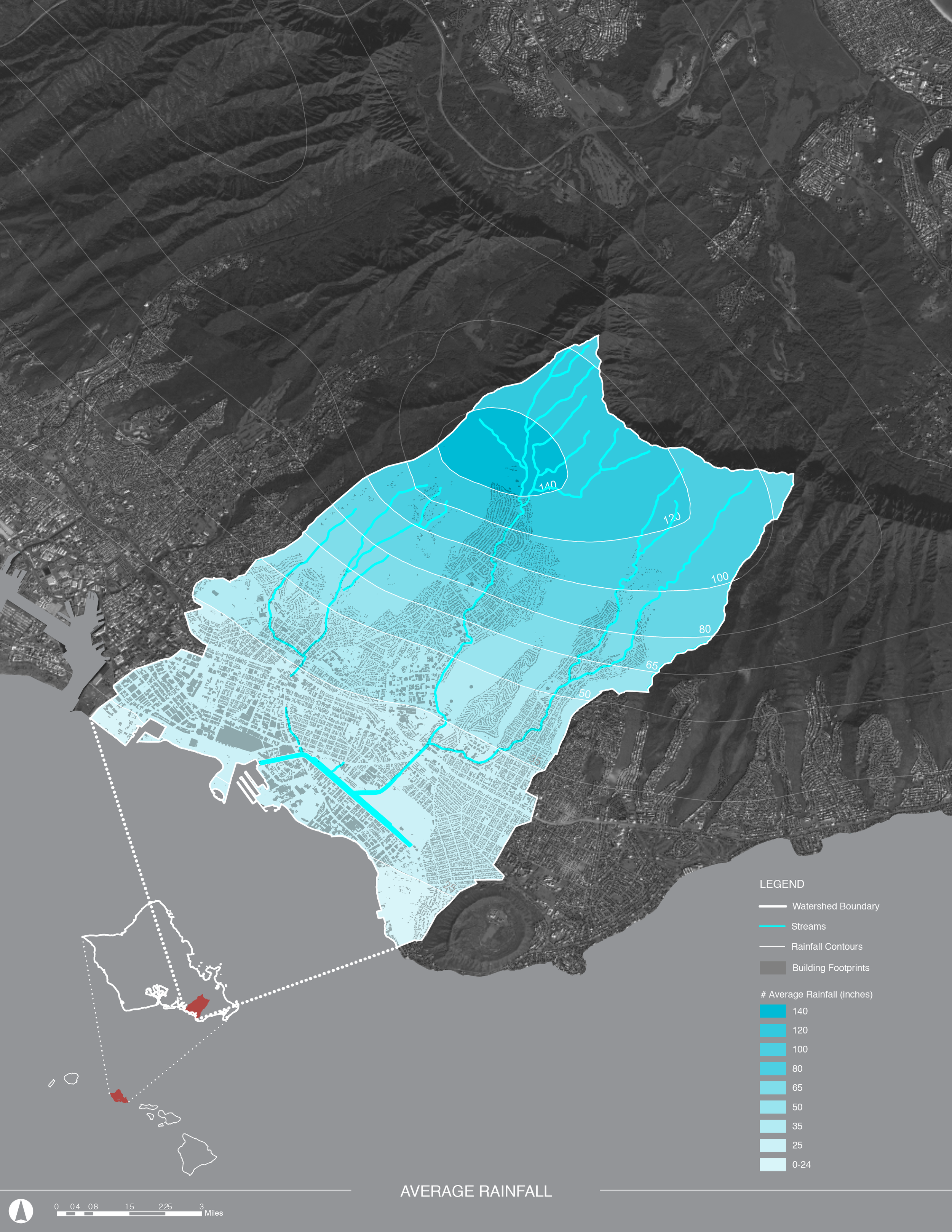
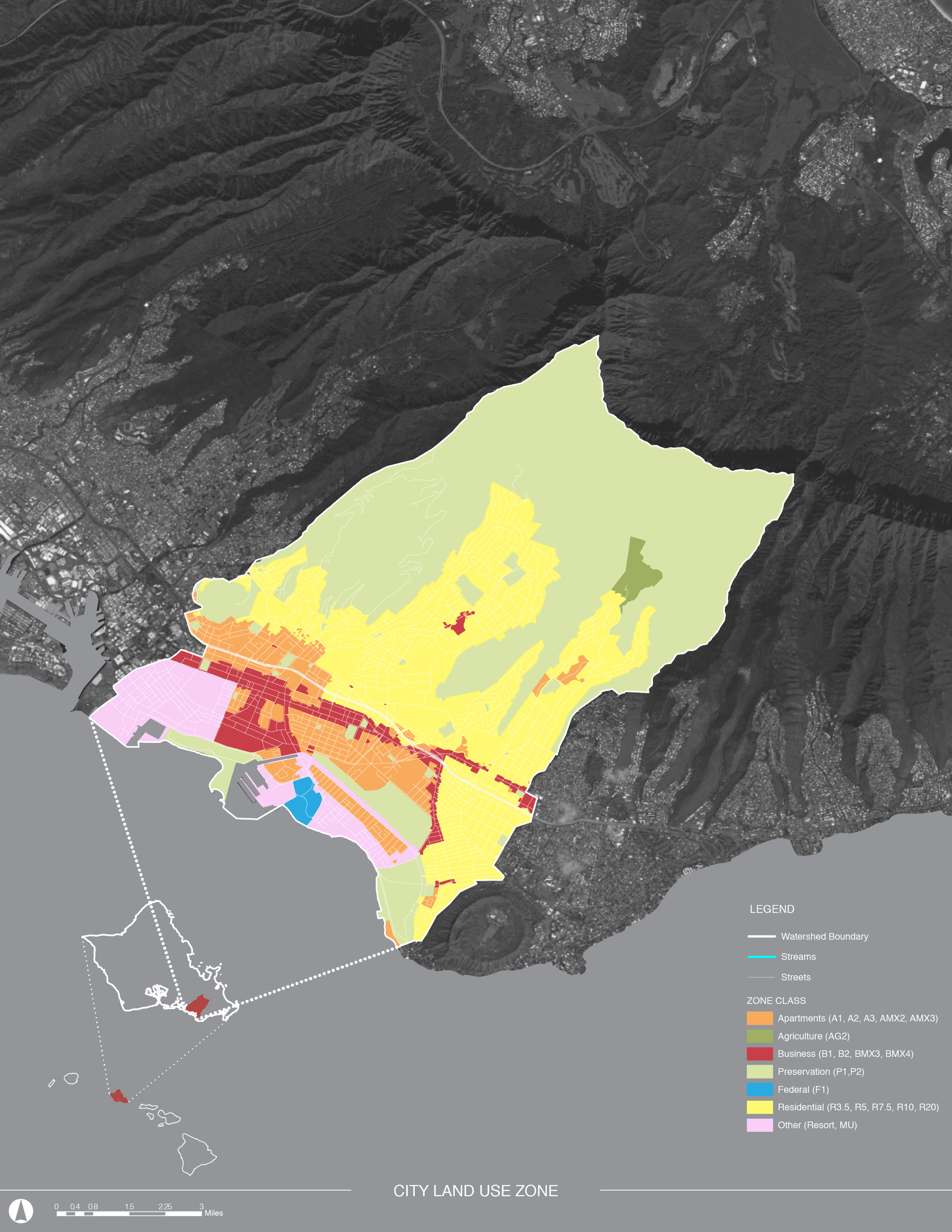
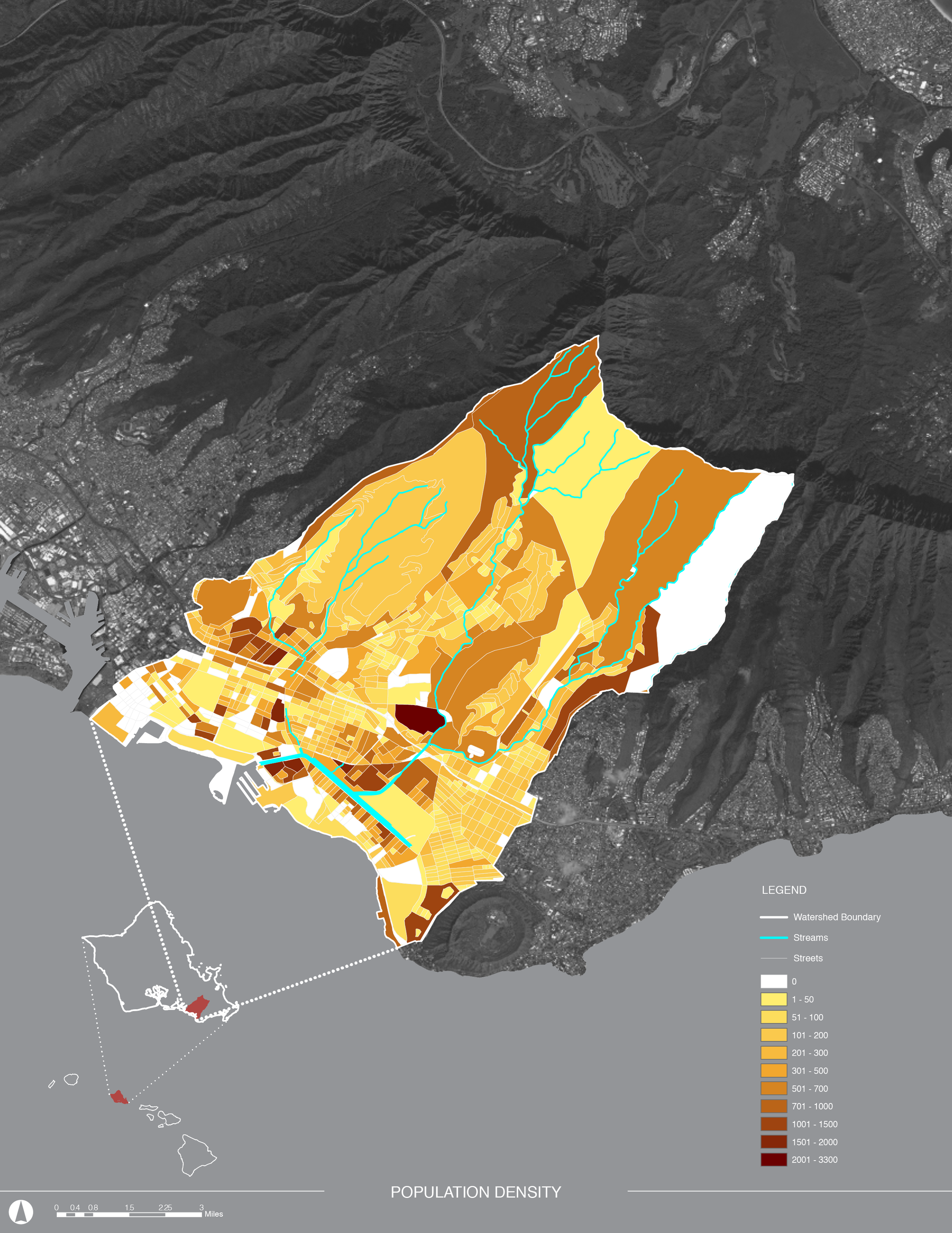
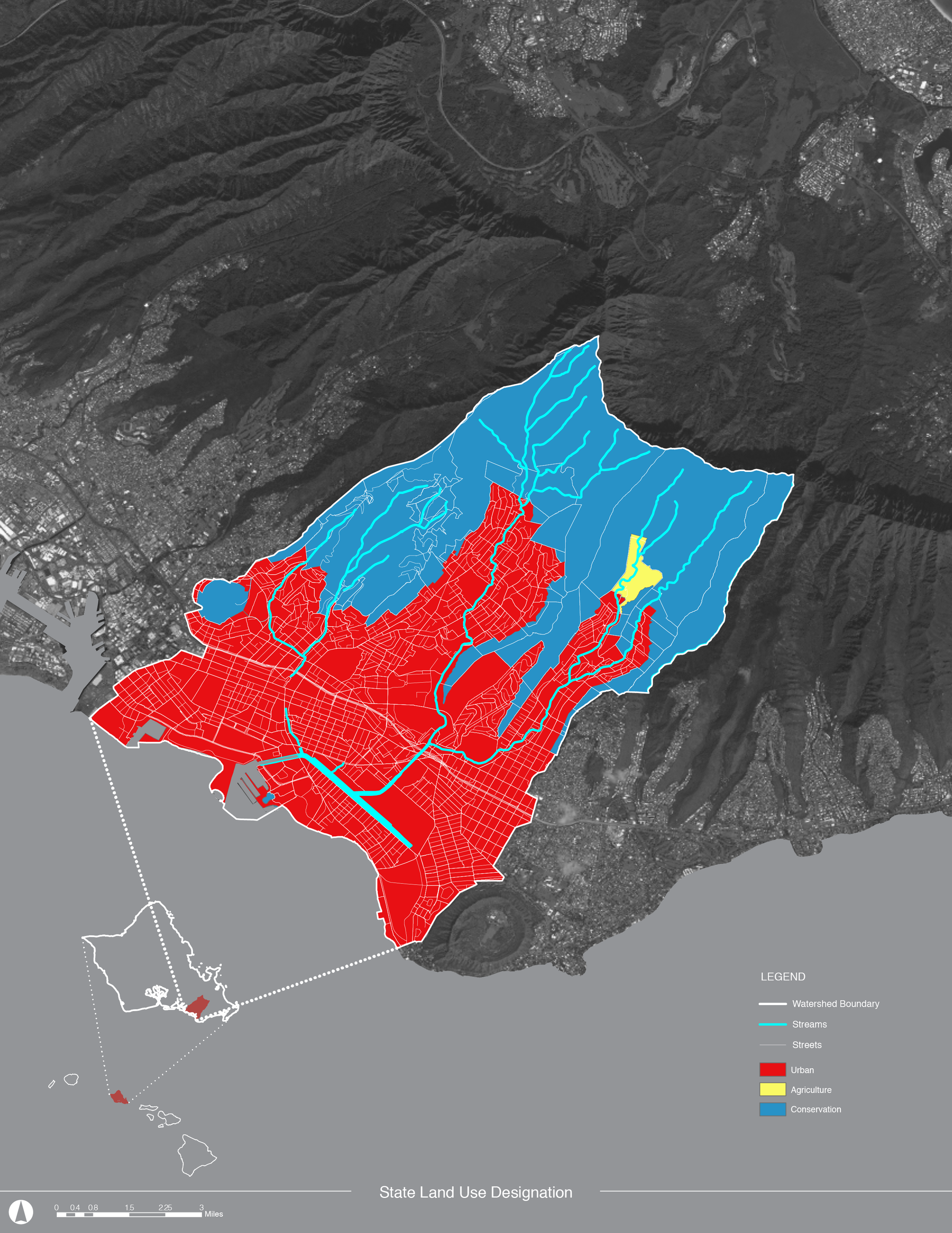
In support of the goals of the Ala Wai Watershed Collaboration, and in partnership with the Institute for Sustainability and Resilience, UHCDC produced a series of maps of the Ala Wai Watershed that compile a range of data from average annual rainfall, electoral districts, sea-level rise, to stream care and restoration. These aim at establishing a baseline of information to share with stakeholders and the public. Information was taken directly from GIS and data provided by AWWC.
Client: Hawaiʻi Green Growth Initiative, Ala Wai Watershed Collaboration
Project Staff: Rebecca Denzer
Student Team: Rubinson Intong